


KC WD15 PCT1513, Jackson County, Missouri
About
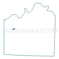
Outline

Summary
| Unique Area Identifier | 608501 |
| Name | KC WD15 PCT1513 |
| County | Jackson County |
| State | Missouri |
| Area (square miles) | 0.49 |
| Land Area (square miles) | 0.49 |
| Water Area (square miles) | 0.00 |
| % of Land Area | 100.00 |
| % of Water Area | 0.00 |
| Latitude of the Internal Point | 39.04054400 |
| Longtitude of the Internal Point | -94.51189530 |
Maps


Graphs
Select a template below for downloading or customizing gragh for KC WD15 PCT1513, Jackson County, Missouri


Neighbors
Neighoring Voting District (by Name) Neighboring Voting District on the Map
- KC WD15 PCT1508, Jackson County, MO
- KC WD15 PCT1512, Jackson County, MO
- KC WD16 PCT1511, Jackson County, MO
- KC WD16 PCT1613, Jackson County, MO
- KC WD16 PCT1616, Jackson County, MO
- KC WD23 PCT2301, Jackson County, MO
- KC WD23 PCT2312, Jackson County, MO
Top 10 Neighboring County Subdivision (by Population) Neighboring County Subdivision on the Map
Top 10 Neighboring Place (by Population) Neighboring Place on the Map
Top 10 Neighboring Unified School District (by Population) Neighboring Unified School District on the Map
Top 10 Neighboring State Legislative District Lower Chamber (by Population) Neighboring State Legislative District Lower Chamber on the Map
Top 10 Neighboring State Legislative District Upper Chamber (by Population) Neighboring State Legislative District Upper Chamber on the Map
Top 10 Neighboring 111th Congressional District (by Population) Neighboring 111th Congressional District on the Map
Top 10 Neighboring Census Tract (by Population) Neighboring Census Tract on the Map
- Census Tract 105, Jackson County, MO (4,912)
- Census Tract 171, Jackson County, MO (3,856)
- Census Tract 163, Jackson County, MO (2,450)
- Census Tract 175, Jackson County, MO (2,028)